


Pelouse (tête)

Patricelecerf
User
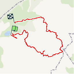

Length
10.9 km

Max alt
2480 m

Uphill gradient
1215 m
Km-Effort
27 km

Min alt
1368 m

Downhill gradient
1168 m
Boucle
No
Creation date :
2016-07-31 00:00:00.0
Updated on :
2016-07-31 00:00:00.0
6h10
Difficulty : Difficult

FREE GPS app for hiking
 SityTrail
IGN / Geographical institutes
SityTrail Plus
The world is yours!
About
Trail Walking of 10.9 km to be discovered at Auvergne-Rhône-Alpes, Upper Savoy, La Clusaz. This trail is proposed by Patricelecerf.
Positioning
Country:
France
Region :
Auvergne-Rhône-Alpes
Department/Province :
Upper Savoy
Municipality :
La Clusaz
Location:
Unknown
Start:(Dec)
Start:(UTM)
304426 ; 5087720 (32T) N.
Comments